Measure any roof.
In minutes. On your device.
RoofScanr turns a quick drone flight into a complete takeoff report — facets, edges, pitch, waste, and a 3D model — without sending your data to the cloud.
How RoofScanr works
From flight to finished takeoff in three steps.
1. Fly the roof
Use any drone to capture a short orbit. RoofScanr guides the path.
2. Process locally
Photogrammetry runs on your device. No uploads, no waiting in a queue.
3. Get your report
Facets, edges, pitch, waste, counts, and a 3D model — ready to share.
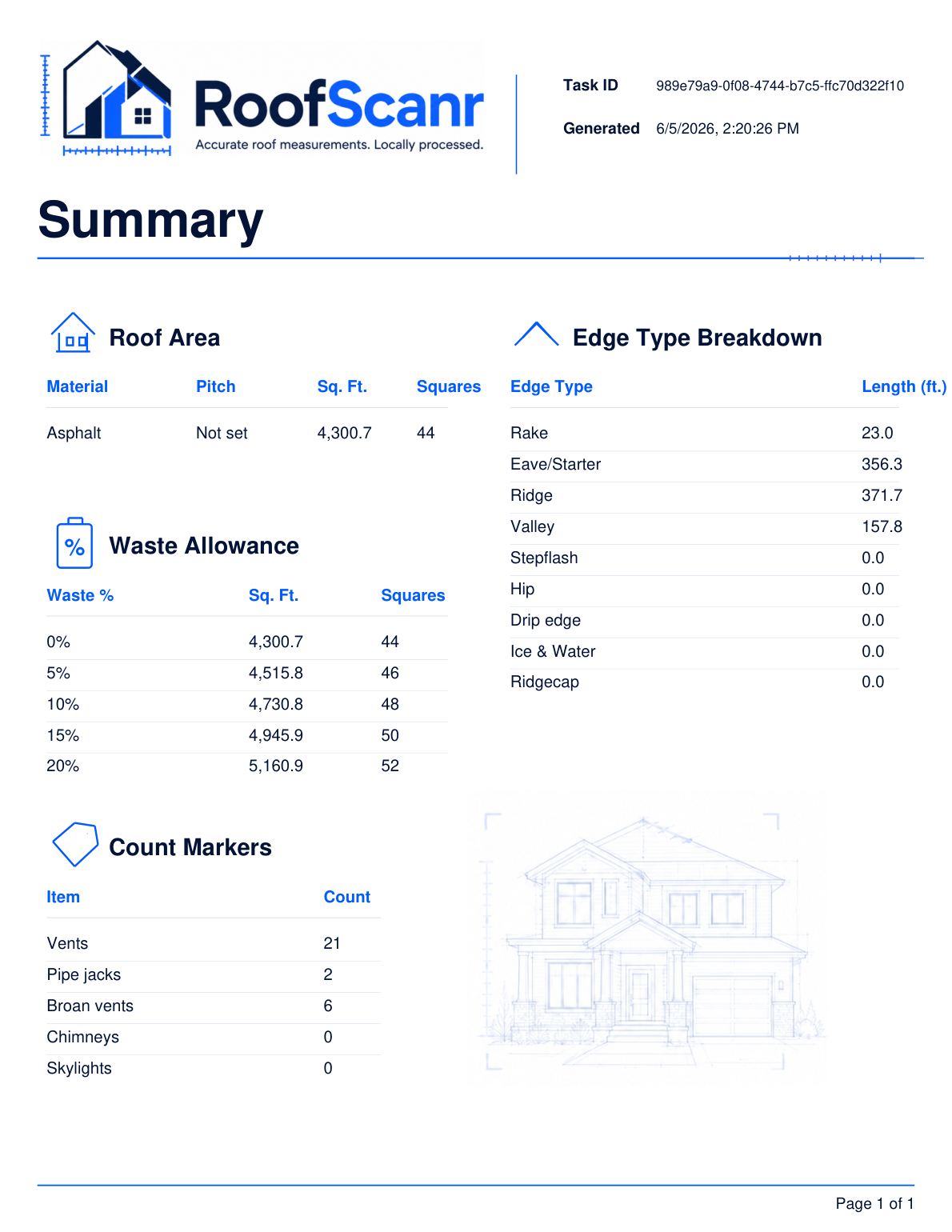
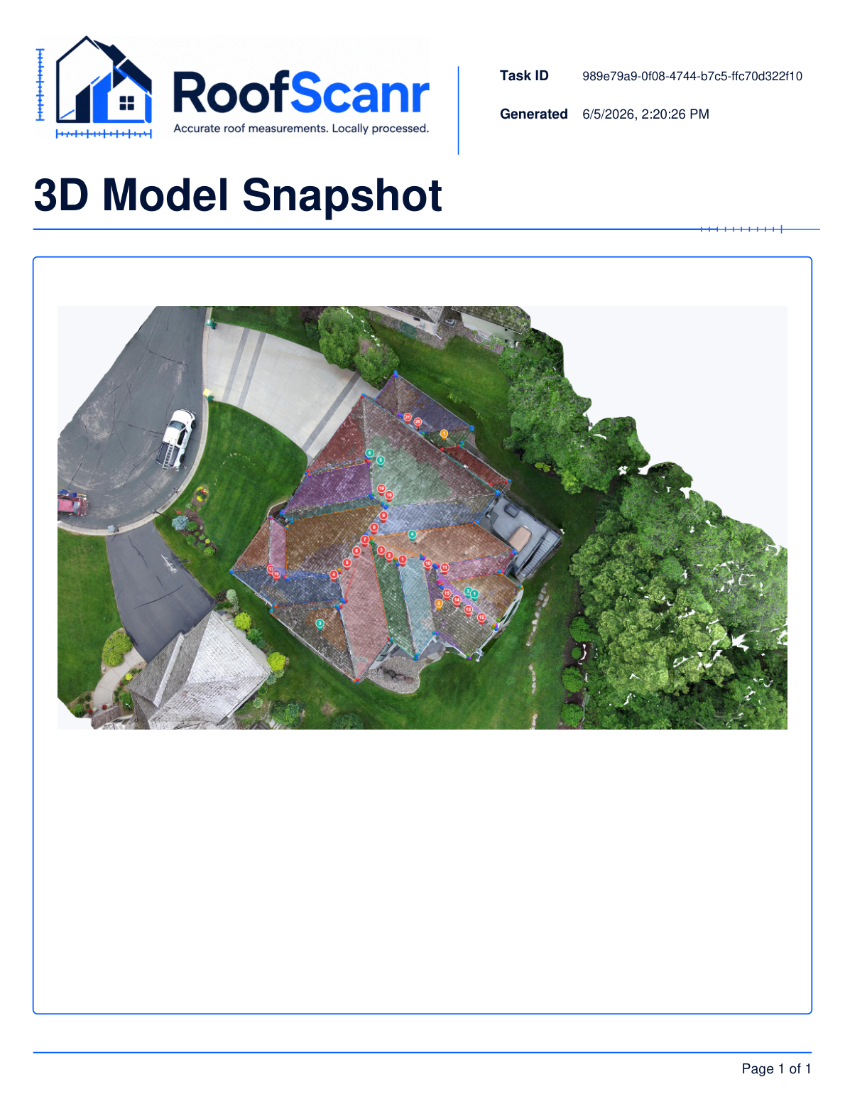
A complete report — for every roof
Here's what a real RoofScanr takeoff looks like. Click "Request info" to see the full PDF.
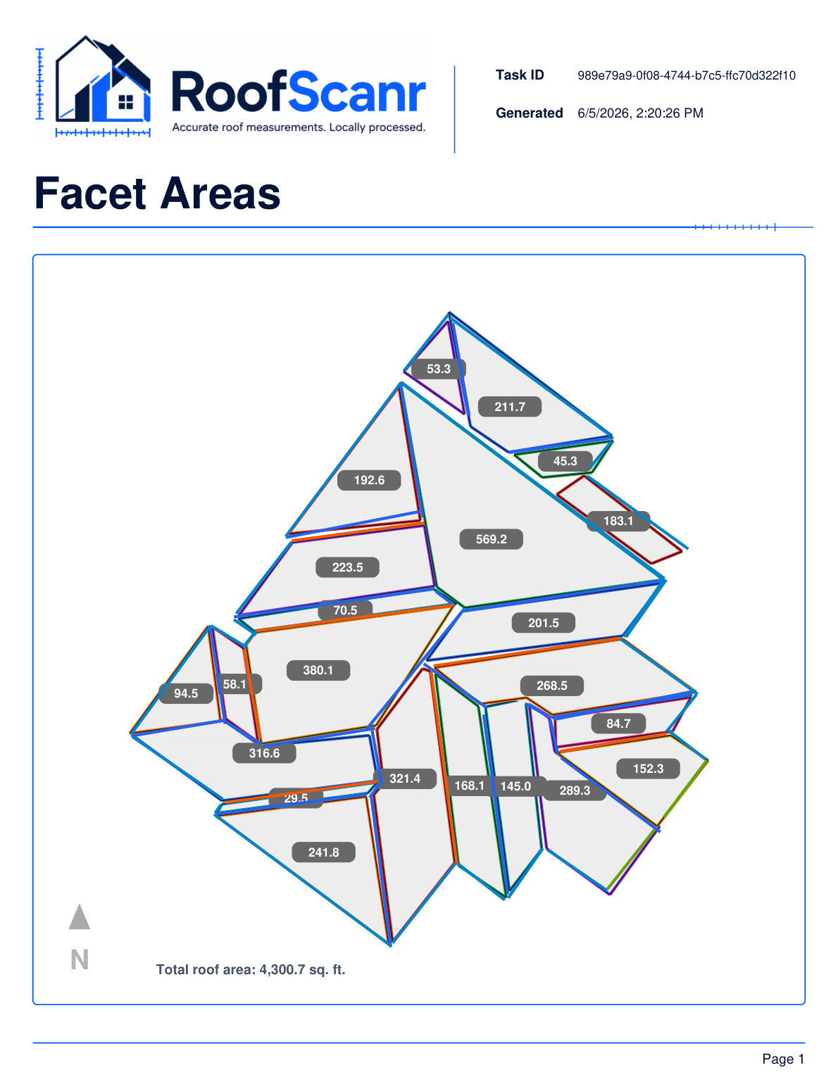
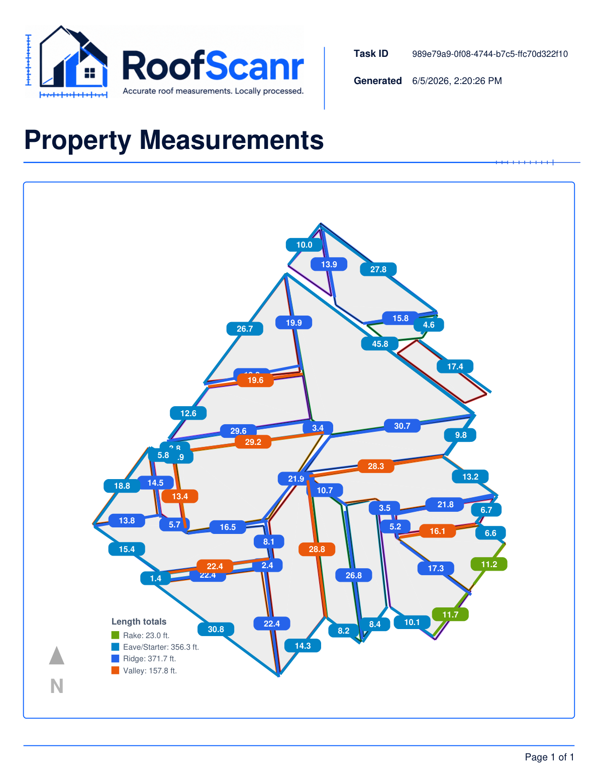
Precise takeoffs
Facet areas, edge lengths, pitch and waste tables you can bid from.
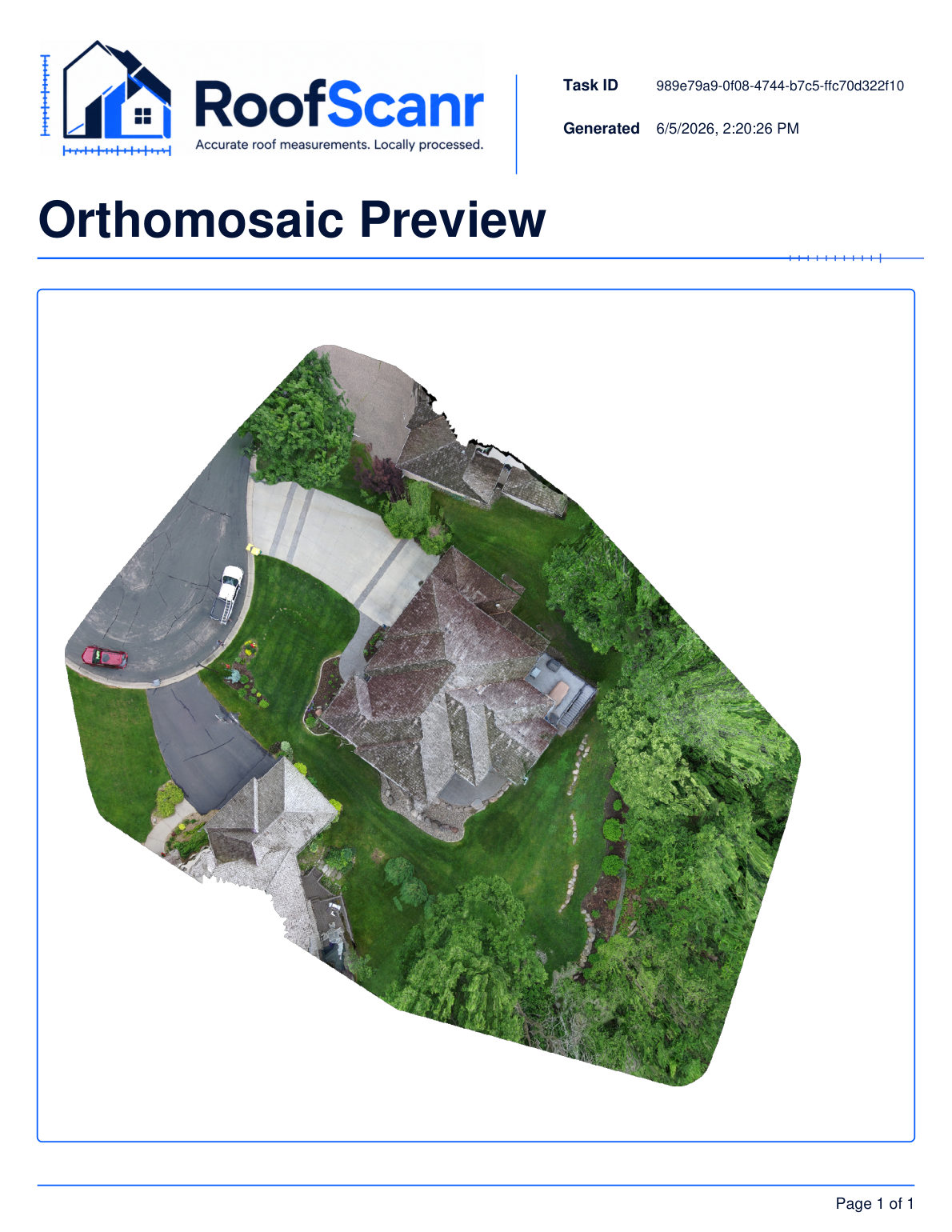
3D + orthomosaic
Textured 3D model and a true-scale orthomosaic, every scan.
Locally processed
Your imagery stays on your device. Faster, private, no usage limits.
See how RoofScanr fits your workflow
Tell us a little about what you do and we'll send a walkthrough, a sample report, and early access details.
- Personalized walkthrough of the app
- Full sample takeoff PDF
- Early access invitation